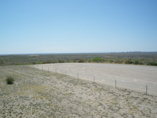
East Texas or the triangle (Dallas-Houston-San Antonio) is home to most of Texas' 24 million people.
West of San Antonio things are different.

The desert takes over and you can go for miles without seeing a single house or building. I went through a rainstorm that felt like I was driving into a wall of night before getting to Del Rio. From Del Rio I drove along the Rio Grande with the 'hills of old Mexico' in view. Gradually the Texas side became more and more mountainous as I got closer to Big Bend.

This is the end of the Pecos River where it flows into the Rio Grande. The sides of both rivers are quite steep at this point and one of the reasons the Rio Grande makes an effective border.
I ended up at Guadalupe Mountains National Park, home to the highest point in Texas at over 8600 feet.

Guadalupe Peak. El 8749' (Highest point in Texas). Guadalupe Mountains is a gorgeous park about 100 miles east of El Paso along the border with New Mexico. Backpacking is next to impossible because there's no water. I opted for a couple of day hikes instead.
(Click on Title Bar for More Pictures)